NUAR explained: the National Underground Asset Register in plain English
What is NUAR?
NUAR – the National Underground Asset Register – is the digital map of all underground infrastructure in England, Wales and Northern Ireland. Collecting data from over 360 public and private asset owners, NUAR gives planners and workers an instant, interactive overview of 3.2 million km of pipes and cables laid by gas, electricity, water and telecoms providers.
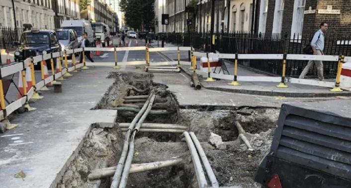
Those pipes and cables represent some of the country’s most vital infrastructure. Any disruption to them equals disruption to the water supply, power supply and communications network vital to the way our country runs. Drill into a water main you didn’t know was there, and suddenly a construction company faces a lengthy, costly clean-up under the scrutiny of local residents wondering why they’re being asked to bathe using bottled water for the next week.
It’s a real problem that NUAR solves by making the right geospatial data easily available to anyone digging up a road or excavating near a gas main. And a solution that the government estimates is worth £400m a year to the UK’s economy.
Who runs NUAR? And how did it come about?
NUAR has been operated by Ordnance Survey since 2024, making use of Ordnance Survey and HM Land Registry data along with information collected by the Government Geospatial Commission during a research programme that stretches back nearly a decade.
It takes time, effort and technology to map millions of kilometres of Victorian plumbing, post-WW2 gas mains and 21st century fibre-optic cabling.
Especially when it’s all been laid in different decades, by different people, with different methods of recording what’s been placed where.
That’s why research on a full registry of crucial underground infrastructure started back in 2018, and the need for a collected underground record was identified as far back as the New Roads and Street Works Act 1991 and the equivalent Street Works (Northern Ireland) Order 1995.
But it’s work well worth doing.
The research carried out proved that NUAR data and an easily accessible underground asset register would help the thousands of ongoing construction and maintenance projects avoid costly and time-consuming delays along with damage to key infrastructure.
Since the launch of the NUAR platform in England, Wales and Northern Ireland in 2024, it’s proved its usefulness for everything from surveys, to excavations, to site safety.
What data does NUAR hold? And where does it cover?
If it’s underground infrastructure and it’s buried somewhere in England, Wales or Northern Ireland, then NUAR either already – or will eventually – cover it in a standardised data model.
Currently, NUAR has mapped over 80% of the known underground assets in these three countries – a total of over 3.2 million kilometres of underground pipes and cables laid by energy providers, telecoms companies, transport organisations and local authorities.
Does NUAR cover Scotland?
NUAR doesn’t cover Scotland. Instead, the Scottish Roadworks Commissioner runs the Scottish Community Apparatus Data Vault (VAULT for short), which makes similar information available in an underground asset register.
The data collected by NUAR gives users an instant overview of the ground they’re standing on – the locations and depth of infrastructure, what it’s connecting and carrying, and where it leads to. All of which means workers can avoid cutting a water main, causing a gas leak, or cutting the internet connection for a whole street.
This data is all standardised using a data model based on the Open Geospatial Consortium’s MUDDI model that describes real-world concepts, spaces and objects, to make it easier for NUAR to grow, update and stay accurate even as the built environment changes. (If you’re interested, you can find the published model on GitHub)
Why NUAR matters: safety and efficiency
Over 60,000 strikes on underground utilities and infrastructure cost the economy over £400 million every year.
That’s according to research from both Ordnance Survey and the government. But it doesn’t tell the whole story.
Not all of those 60,000 strikes have an equal impact. A strike that damages a water main leaves people unable to shower, clean, or access drinking water. Damage communications cabling instead, and affected people can find it harder to work. And an accidental strike on electricity or gas infrastructure can pose a genuine threat to safety.
A lack of safe digging costs money, costs time, and can even cost lives and livelihoods.
Without NUAR access, it can take over six days to gather all of the information needed to identify where’s safest to dig. Requests need to go to different agencies and organisations, then collated and compared. Factfinding becomes an even bigger time instead of eliminating wasted time.
And it’s why NUAR is so important. A unified national underground asset register that can be checked in moments will reduce strikes, and the avoidable danger, delay and costs that result.
An end to £400m of delays and damages. All in a matter of seconds.
Who can access NUAR, and what’s set to change?
Mapping millions of miles of underground utilities and keeping that map up-to-date is a challenging process, which means NUAR didn’t spring into action fully formed and ready for public access.
Here’s where you stand as of August 2026.
Currently, you can access NUAR by invitation only. NUAR has been offered to a range of key asset owners who are using it as part of their workflows and plans. This includes the owners of infrastructure – water companies, energy providers and telecoms businesses – who need to know where assets are currently located. It also includes local authorities and highways authorities and their authorised contractors, so that government projects can make use of NUAR too.
But when will NUAR be publicly available? How can you access it?
The answer is that it’s still not clear. There’s a case to be made for members of the public and emergency services to have access, especially for safe digging, along with the wider public sector. But consultations are ongoing.
A public beta opened in spring 2025, followed by a public consultation in spring 2026, which suggests a gradual, phased opening up of NUAR data for safe digging as we near 2028.
What does NUAR mean for GeoTech and PropTech founders?
So far, you may have an image of NUAR as a public good. A tool operated by Ordnance Survey to make life easier, more efficient and safer for contractors working on public infrastructure projects.
That’s true. For now. But the real value of trusted geospatial data to UK entrepreneurs and innovators can’t be understated. It all comes down to location intelligence.
Access better location intelligence
Location intelligence lets you understand an area more deeply. You can analyse not just what’s located in a place, but what’s happening there, and why. With access to that geospatial data and location intelligence, you can make more informed decisions on everything from construction to insurance premiums, opening up a whole host of opportunities for GeoTech and PropTech alike.
And you don’t need to wait for NUAR to be publicly available. As we’ve explained, the benefit of NUAR is the information it holds. And while we’ve not mapped every inch of 1950s piping on Shoreditch High Street, our Geovation Accelerator Programme does offer you key location information, tech and data support, and accurate location data collated by Ordnance Survey and HM Land Registry.
If you’d like privileged access to location, land and property data, maybe it’s time you joined the Geovation Accelerator Programme?
NUAR FAQs
What does NUAR stand for?
NUAR stands for National Underground Asset Register and contains a map of underground infrastructure in England, Wales and Northern Ireland.
Who operates NUAR?
NUAR is a UK Government register operated since 2024 by Ordnance Survey.
Is NUAR open to the public?
As of August 2026, NUAR is only open by invitation. A consultation and phased roll-out to the general public is planned to take place by 2028.
Is NUAR free to use?
Legislation laid out in The Data Use and Access Bill requires asset owners to fund the running costs of NUAR, which means it remains free at the point of use for any organisation with access.
Does NUAR cover Scotland?
No, NUAR doesn’t cover Scotland. Instead, VAULT makes similar location information available to eligible organisations and companies working in Scotland.