PropTech Innovation Challenge

Unlocking 1.5 Million Homes: Progress from the PropTech Innovation Challenge
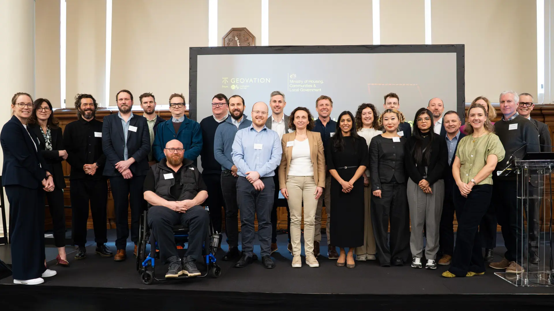
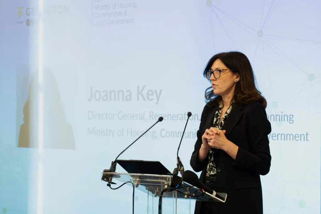
The PropTech Innovation Challenge reached a significant milestone with an in‑person event at Central Hall Westminster on Tuesday 10 March, bringing together innovators, public sector partners and industry stakeholders to share early outcomes from 12 live digital pilots.
Delivered through collaboration between MHCLG’s Digital Planning Programme and Geovation (an Ordnance Survey initiative), the event highlighted the emerging impact of real‑world testing in planning and development contexts, and set the stage for the next phase of insight consolidation and future collaboration to support sector‑wide adoption and scalability.


Driving scalable innovation in housing delivery
The PropTech Innovation Challenge (PIC), a government-backed initiative, was designed to accelerate the delivery of 1.5 million homes in England. The Challenge was rooted in cross-sector collaboration, bringing together startups, local authorities, housing developers, and government bodies to co-create digital tools that address systemic barriers in planning and housing — including access to land data, viability of small sites, and infrastructure certainty. With £1.2 million in funding, the programme’s development phase is complete and the pilots have tested and proven their solutions in live environments across England.
Strategic priorities
The Challenge was shaped through extensive consultation and research, with housing, planning, and technology stakeholders. It focused on three core areas for innovation:
- Making land data work for everyone – improving transparency and usability of land ownership data
- Unlocking small sites potential – reducing planning risk and cost for smaller developments
- Providing infrastructure certainty – increasing clarity around infrastructure connections to support feasibility and investment
Together, these priorities aimed to stimulate innovation, particularly among SMEs and local developers, and help transform how housing is planned, approved, and delivered across the country.
How might we transform currently siloed and proprietary land ownership data into an open and interoperable resource that accelerates the conversion of potential development sites into tangible housing projects?
METRICS
- An increase in the number of additional houses built.
- A reduction in the time it takes, or cost for a developer to assess land viability.
- A reduction in the time it takes or cost for a developer to identify and contact a landowner to discuss land viability.
- A reduction in the time it takes a developer to purchase the land from a landowner.
- An increase in the number of land ownership insights that help developers and LPAs understand land ownership, its complexity, and opportunities at a local level.
- An increase in the number of small sites that developers are aware of and can bring forward for development.
How might we increase the attractiveness of small sites for SME developers and other new market entrants through streamlining the processes involved in small site development?
METRICS
- An increase in the number of additional houses built.
- An increase in completed schemes.
- An increase in the number of SME developers or new market entrants.
- A reduction in the number of planning refusals.
- A reduction in the time it takes to be granted planning permission.
- An increase in investor confidence in the ability of developments to deliver an ROI.
- An increase in financial investment in small site developments.
How might we de-risk housing projects and unlock a surge in developer activity by giving developers and local planning authorities absolute certainty and radical transparency regarding existing and future infrastructure capacity?
METRICS
- An increase in the number of additional houses built.
- An increase in completed schemes.
- A reduction in the number of planning resubmissions due to infrastructure issues
- An increase in the number of open, actively managed infrastructure datasets that are shared, England-wide, with all LPAs, landowners, and developers.
- An increase in investor confidence in the ability of developments to deliver a return on investment.
Challenge Deep Dive
Read the full research report for more about the key challenges facing housing delivery, stakeholder perspectives, methodology, and metrics for success.

Meet the winners
Twelve teams were selected to receive up to £100,000 each to develop their solutions. Their pilots span AI-powered platforms, infrastructure mapping tools, and digital planning assistants — all designed to reduce delays, improve transparency, and enable faster, smarter development.

1st Planner Ltd.
Optimise is a digital platform that identifies surplus education land for housing; combining estate data, BB103/BB104 assessments and ownership records. Built with Microsoft Fabric, Vercel and Cesium 3D GIS, it ensures DfE Section 77 compliance and generates capital to renew aging school estates.
PARTNERS: Sheffield City Council; City of Wolverhampton Council; Tameside Council; Archdiocese of Birmingham; Archdiocese of Liverpool; Diocese of Shrewsbury; Diverse Academies Trust; Meridian Trust; Respect Collaboration of Schools
Problem Statement 1
Advanced Infrastructure Technology Ltd
Advanced Infrastructure builds spatial planning tools for Utilities & Local Authorities to co-create Local Area Energy Plans. Our software tools enable local authorities to undertake complex engineering tasks without external consultancy support, unblocking millions of pounds in low carbon projects.
Problem Statement 3

Alchera Technologies
Alchera AI transforms housing transport assessments from months to minutes using AI-powered analysis. It streamlines processes and improves section 106 assessments for developers and councils, creating shared intelligence that accelerates planning approvals and supports housing delivery targets.
PARTNERS: Milton Keynes City Council
Problem Statement 3

City Science
Development of a digital infrastructure standard, initial platform build, stakeholder testing, and U-Log 1.0 pilot implementation.
Problem Statement 3

Coplug
A geospatial AI module enabling collaborative, data-driven planning by linking housing growth to infrastructure capacity. Built on a unified data model, it delivers location-based insights to accelerate development and support sustainable growth.
PARTNERS: Greater Norwich Growth Board; Canterbury City Council; Runnymede Borough Council
Problem Statement 3
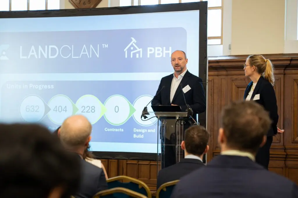
LANDCLAN
LANDCLAN is using AI to accelerate 1000 sites through planning in the next 3 years. Contracting with modular housebuilders who employ prisoners and ex-offenders to build new homes.
PARTNERS: Prisoners Building Homes; Microsoft; ESRI
Problem Statement 2

Libra
Libra is an AI legal assistant helping the public and SMEs to understand and resolve legal issues, with support from professionals where advice is needed. Geovation is supporting the Libra team to incorporate planning laws and an AI Planning Assistant within Libra.law.
PARTNERS: LDA Design; Blackberry Consulting; Town Legal; Thrings
Problem Statement 2

Neuron
Neuron is a digital tool that can quickly assess if existing water, power and sewer infrastructure can support proposed housing developments. By automating building demand calculations and combining them with infrastructure data, the platform can generate clear reports in hours, not months.
Problem Statement 3
PlanningHub
PlanningHub automates planning research for small sites including social and community-led housing. Our reports cut time by 96% and costs by 80%, unlocking site potential and making planning faster, clearer, and more accessible.
PARTNERS: Aster Group; Youngman Lovell; Cosy Hauz; Tower Hamlets; Test Valley; Community Land Trust Network; Lichfields
Problem Statement 2

RCKa
We’re using innovative AI tools combined with geospatial analysis to identify and evaluate every unrealised small site housing infill opportunity in the country.
PARTNERS: London Borough of Lewisham; London Borough of Ealing; Blocktype
Problem Statement 2
RenKap
The Small Site Accelerator, by RenKap and Blocktype, unlocks small site development by streamlining due diligence, surveys, and feasibility design—cutting cost, risk, and time to turn raw sites into de-risked, concept-ready projects.
PARTNERS: London Borough of Lewisham; London Borough of Lambeth; Bristol City Council; Wigan Council
Problem Statement 2

Xylo
Patch uses AI to help local planning authorities deliver pre-application advice to SME developers up to 90% faster. Co-designed by tech startup Xylo and Leeds City Council, it offers higher quality processes with full officer oversight, reducing planning uncertainty and boosting UK housing delivery.
PARTNERS: Leeds City Council
Problem Statement 2
Pilot Partners


Guiding the Selection
The judging panel brought together more than 55 experts from MHCLG, Department for Business and Trade, Environment Agency, HM Land Registry, Homes England, 10 Downing Street, local authorities and other institutions to assess submissions against a clear set of criteria: innovation, scalability, feasibility, and potential for impact.

Insights & Articles
PropTech innovation takes on housing delivery challenges
MHCLG Digital
Winners of PropTech Innovation Challenge
Ordnance Survey
Putting innovation at the heart of unlocking small sites
MHCLG Digital


In collaboration with the Ministry of Housing, Communities and Local Government (MHCLG)