Geospatial technology: shaping the future of real estate

The real estate sector is one of the largest and most economically significant in the global economy. However, the industry is also facing significant changes and challenges, driven by a range of factors such as economic uncertainty, changing regulations, Brexit, and the aftershocks of the Covid-19 pandemic. In this complex and dynamic landscape, geospatial technology is playing an increasingly important role, providing valuable insights and innovative solutions for real estate professionals.
At its core, geospatial involves the capture, analysis, and visualisation of data related to geographic locations. This data can come from a range of sources such as satellite imagery, aerial photography, and on-the-ground surveys. By integrating this data with other sources, such as demographic and economic data, geospatial experts can provide a comprehensive view of the real estate landscape, helping real estate professionals make more informed decisions about property investment, development, and management.
Benefits of geospatial for the real estate industry
One of the key benefits of geospatial for the real estate industry is the ability to analyse and visualise information in a spatial context. By viewing property data on a map, real estate professionals can gain a better understanding of the relationship between properties, amenities, transportation, and other factors. This type of analysis can provide valuable insights into property values, trends, and potential opportunities.
For instance, geospatial data can be used to identify areas with varying levels of potential for development or sites where property values are likely to increase in the future. This analysis can help real estate professionals make more informed decisions about where to invest in properties and how to price them. This data can also be used to assess the impact of environmental factors, such as natural disasters or pollution, on property values and risks. Another important use-case is for site-selection and development planning: assessing the feasibility of projects becomes streamlined and risks can be minimised. Through the analysis of this data, real estate professionals can make more informed decisions about property investments and management.

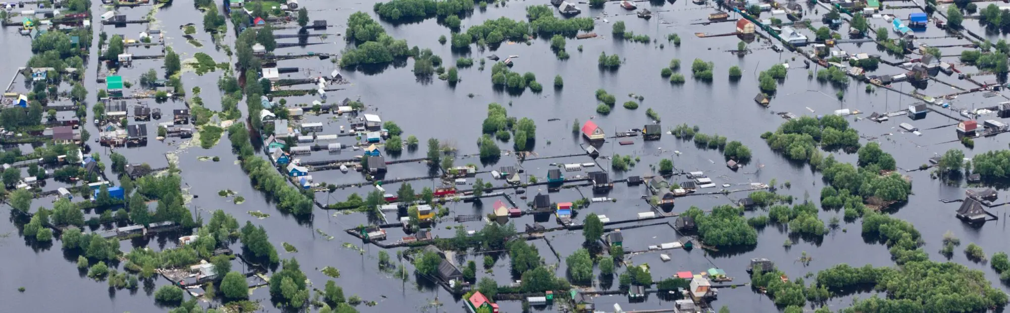
Tracking climate change and other environmental risks
Crucially, geospatial technology can be used to track climate change and other environmental risks, allowing stakeholders to make informed decisions about how to mitigate these threats. For instance, geospatial data can be used to identify areas at risk of flooding or other natural disasters, allowing real estate professionals to take measures to protect their properties and investments.
The importance of geospatial technology in the industry is only expected to grow in the coming years. As the industry faces new challenges and opportunities, geospatial experts will play a critical role in providing valuable insights and innovative solutions. Yet, the successful integration of geospatial technology into the real estate industry will require collaboration and standardisation, as well as maintaining an eye on sustainability and climate change mitigation.
With an eye to the future, the prevailing macroeconomic headwinds combined with the physical and transitional risks of climate change and net zero goals leave the industry at a crossroads. With the help of geospatial technology, real estate professionals can navigate this complex and dynamic landscape, creating value and managing costs effectively. As the industry continues to evolve and adapt, geospatial experts will be essential partners in shaping a more sustainable and efficient future for the real estate industry and beyond.